Walker River Paiute Tribe
Water Resources
Contact Details
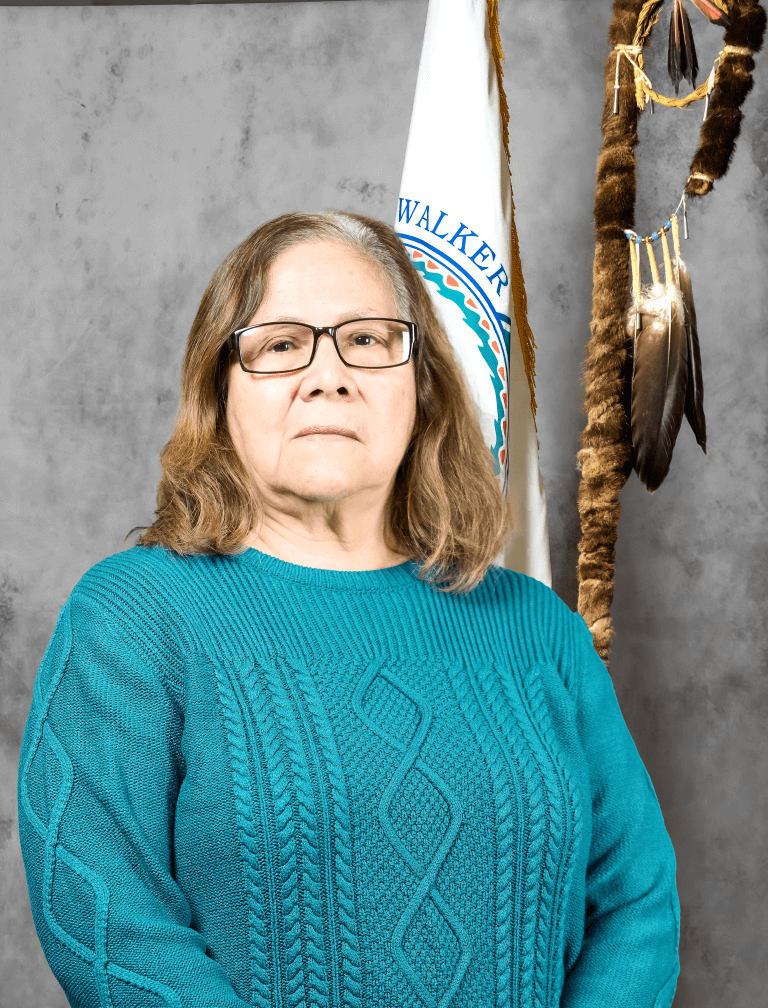
Elveda Martinez
Water Resources Coordinator
Email – [email protected]
Roy Begay
Non-Point Source
Email – [email protected]
Marlene Begay
Climate Change Coordinator/Finance Monitor
Email – [email protected]
Jon D. McMasters
Land Coordinator
Email – [email protected]
Gina Wachsmuth
Water Quality Specialist
Email – [email protected]
Quick Links
About Us
The Walker River Paiute Tribe Water Resources Department is in charge of water and natural resources, such as water rights, irrigation, non-point sources, climate change, riparian improvement, land, agriculture, rangelands, water quality, construction, and renewable energy. The Water Resources Department staff conducts grant writing, administration, and project development. Staff continues to work with several tribal, state, and federal agencies and partners on projects, i.e. Bureau of Indian Affairs, United States Department of Agriculture, Farm Service Agency, Natural Resources Conservation Service, Cattlemen and Consultants.
Our Mission
The mission of the Water Resources Department is to preserve, protect, and enhance the water and lands of the Walker River Paiute Reservation.
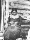
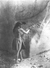
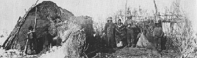
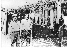
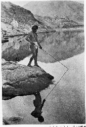
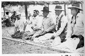
In the beginning the Numa (the people or the Northern Paiute as they are called today) came to the land called the Great Basin in boats. All the land was covered with water. As the water subsided the People moved down from the mountaintops into the valleys in search of food. The People were named after the plants or animals that grew or lived in their area. Those in the region around Agai Pah (Trout Lake or Walker Lake is it is called today) were the Agai Diccutta (Trout Eaters) and the Pugwi Diccutta (Fish Eaters). Those with whom the People had the most contract were the Toi Diccutta (Tule Eaters) to the north, the Tubusi Diccutta (Grass Bulb Eaters) to the west, and the Cozabee Diccutta (Fly Larvae Eaters) around Mono Lake to the south…
Frequently Asked Questions
What is Nonpoint Source Pollution:
Nonpoint source generally results from land runoff, precipitation, atmospheric desposition, drainage, seepage or hydraulic modification. The term “nonpoint source” is define to mean any source of water pollution that does not meet the legal definition of “point source” in section 502(14) of the Clean Water Act. That definition states: The term “point source” means any discernible, confined and discrete conveyance, including but limited to any pipe, ditch, channel, tunnel, conduit, well, discrete fissure, container, rolling stock, concentrated animal feeding operation, or vessel or other floating craft, from which pollutants are or may be discharged. This term does not include agricultural storm water discharges and return flows from irrigated agriculture.
Unlike pollution from industrial and sewage treatment plants, nonpoint source (NPS) pollution comes from many diffuse sources. NPS pollution is caused by rainfall or snowmelt moving over and through the ground. As the runoff moves, it pickups and carries away natural human-made pollutants, finally depositing them into lakes, rivers, wetlands, costal waters, and ground waters.
Nonpoint Source Pollution Can Include: Excess fertilizers, herbicides, and insecticides from agricultural lands and residential areas — Oil, grease, and toxic chemicals from urban runoff and energy production — Sediment from improperly managed construction sites, crops and forest lands, and eroding streambanks — Salts from irrigation practices and acid drainage from abandoned mines — Bacteria and nutrients from livestock, pet wastes, and faulty septic systems — Atmospheric deposition and hydromodification.
States report that nonpoint source pollution is the leading remaining cause of water quality problems. The effects of nonpoint source pollutants on specific waters vary and may not always fully accessed. However, we know that these pollutants have harmful effects on drinking water supplies, recreation, fisheries and wildlife.
Above paragraphs from Environmental Protection Agency (EPA)
Videos
Projects
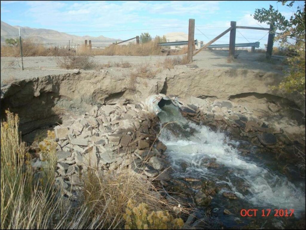
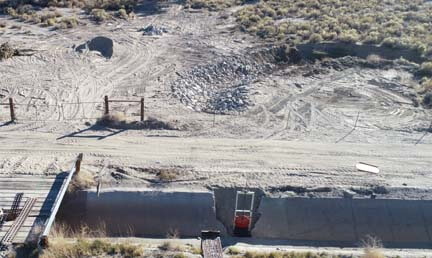
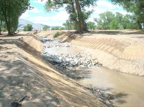
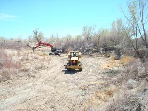
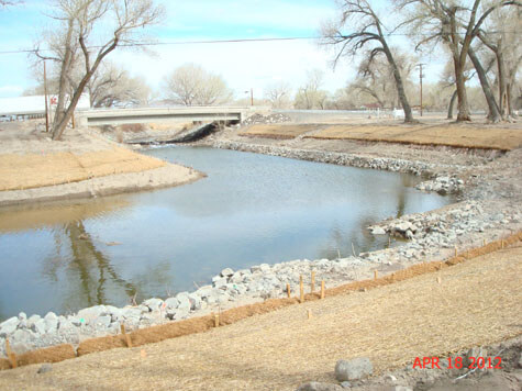
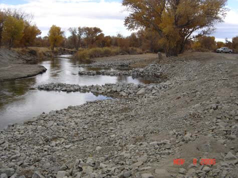
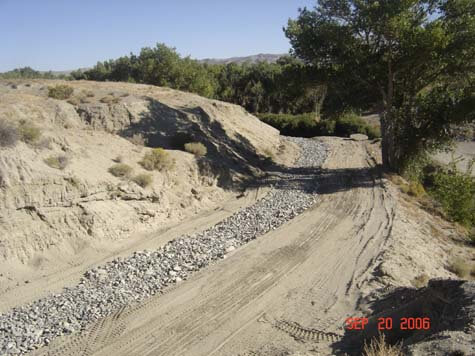
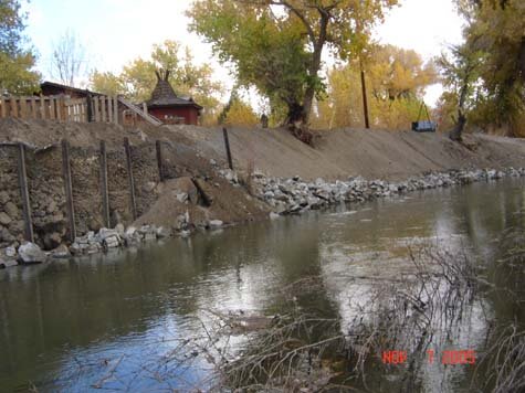
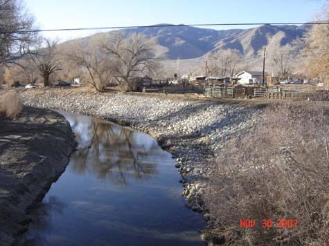
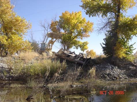
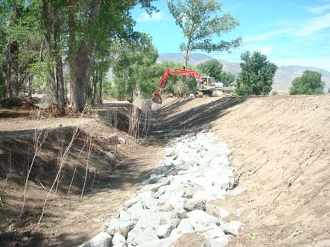
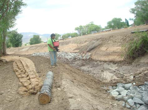
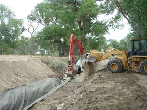
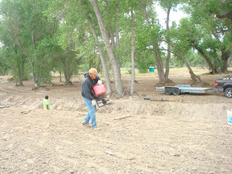
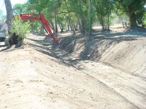
Photos below are the before and after construction by Canal-1, this was a grant funding from EPA for reducing sediment loading into the Walker River, the project was delayed due to issues with landowner consent & Army Corps of Engineers permitting. Project completed in October 2020
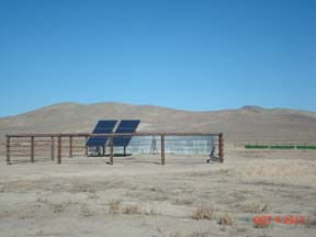
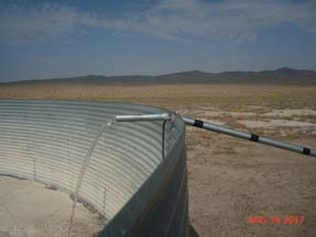
Photos below are the before and after installation of the solar generated power for the Hicks Well, the well was previously run by diesel fuel generator. The well serves about 500-head of cattle when they are in this grazing lot.
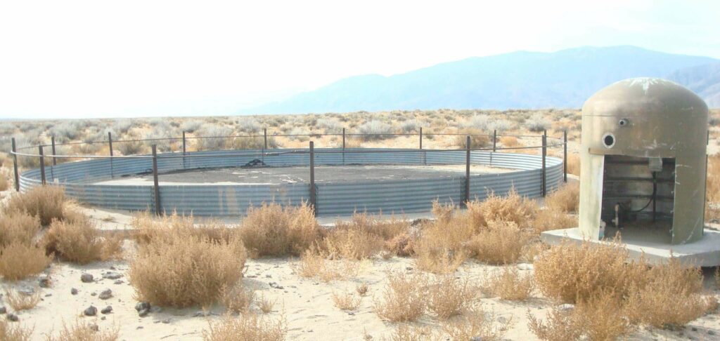
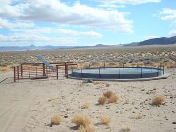
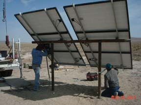
Photos below are before and after the new well was developed, solar generated power to the pump was installed, this facility will serve 500-head of cattle in this grazing lot. This project was funded by the USDA NRCS-EQIP from our local offices in Nevada.
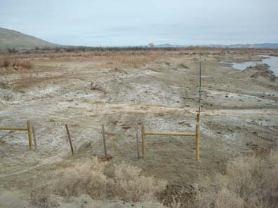
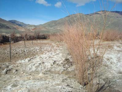
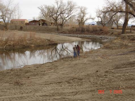
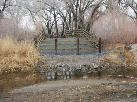
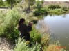
Photos below are taken at one of the Tribe’s water quality sampling sites on the Walker River, the crew planted willows & installed fencing, the objective is to find out if willows can be re-established in this area with salt cedar as the predominant plant species. This pilot project site is located on the lower Walker River close to Walker Lake.
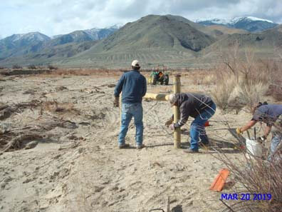
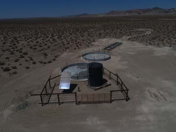
This site is at the Buckskin Well, which is located on the north end of the Reservation for grazing cattle & wildlife, the Tribe received funding from NRCS-EQIP and workforce from the Tribal Cattlemen’s Association to make all this happen, a big thanks to them for a successful project.
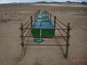
For 2018 year we are putting in another grant request with NRCS-EQIP Program to run a pipeline from the green livestock troughs (photo below)to a mile long stretch to another set of new troughs to serve another section of grazing lot, the project plans are pre-completed; this will be phase 2 of this project.
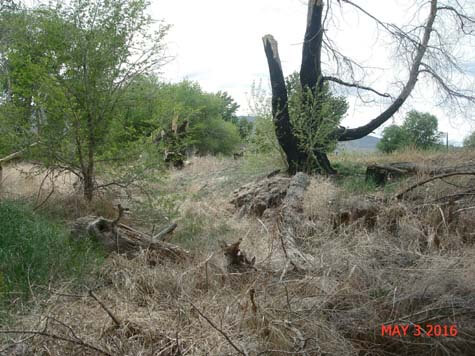
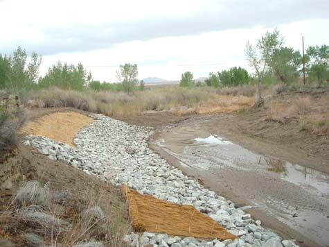
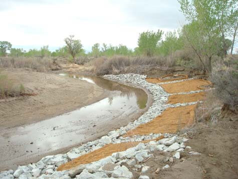
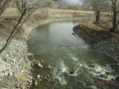
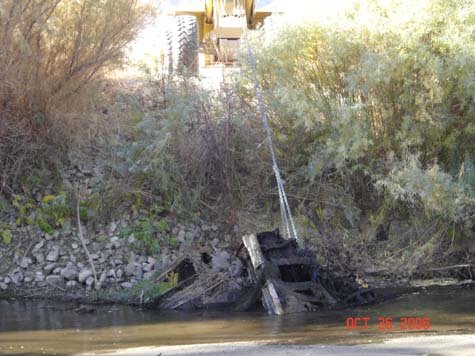
This site was restored to stabilize an eroding bank, thus preventing sediment loading into the river – a nonpoint source pollution prevention practice
Non-Point Source Pollution Program
Welcome, I’ve updated to current day of April 5, 2022, read below.
First of all, I would like to thank all the work done by the Walker River Cattlemen’s Association Members and their work crew, they are the ones that make these projects run smooth and on time. They are very skilled and have a lot of knowledge to complete these projects. Thank You, I would have not done it without you.
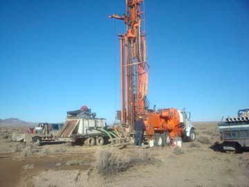
Update: We received a grant from USDA-NRCS EQIP Funding to establish a new well (West Hwy 95 Well) this year (2021), it’s located between US Hwy 95 Lil’ Dam Road in Schurz. The project consist of a new well drilling, new troughs/tanks, and installation of a solar panels & pump, the project is much like the Rawhide Well Project. Currently we are in the final stages of completion, the work crews are laying cement for the base of the big round tanks, once completed, the crew will install the protection fencing for the solar panels and well head.
The program submitted a grant proposal to EPA for 2021&2022 fiscal year, the grant if selected will establish a new well in the upper river known as the Wetlands Complex, the new well to be drilled will include a solar pump, solar panels to generate power. It will also include a new water tanks/troughs for livestock & wildlife needs. We were successful in receiving the grant from EPA, currently we are working with the well drilling contractor to drill for water at this site, I will update as we continue with this project.
We were successful and awarded a grant from EPA for the fiscal year 2020/2021, this is for the Competitive Watershed Grant. The grant will be used to update an existing well (Robber’s Roost Well), it will include new solar pump, solar panels to generate power, new water troughs/tank for livestock & wildlife. This well is located in the upper Northeastern part of the reservation and is very remote.We were successful on receiving the grant for this site. Currently we are 90% complete on this project, well was re-piped, new solar panels were installed, big round tank was setup and cement was poured. I will update more when we are fully completed.
I’ll update new activates and progress as we proceed. Thanks for Visiting, Roy Begay – Non-Point Source Coordinator
Irrigation Return Flow Ditch Photos
EPA Water Quality (106) Program
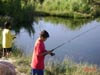
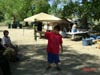
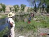
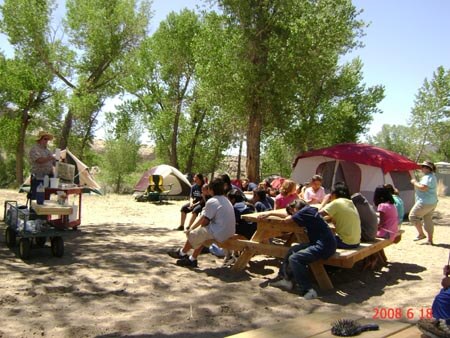
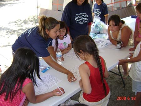
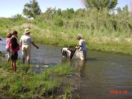
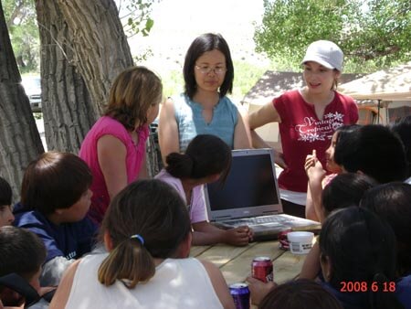
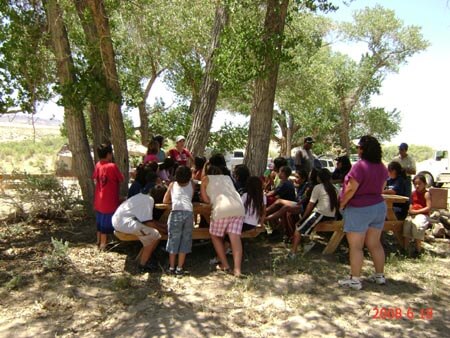
The EPA 106 Program held it’s water quality camp for kids in June ’08, this camp was design to teach kids to respect and learn the importance of water quality; the kids got to experience a hands on education from presenters and also had fun camping, fishing, playing games, and listening to cultural stories & songs. This camp was held at Weber Reservoir downstream of the dam.


Wildlife Conservation
Send a Contact Form
Contact Details
Phone Details
Phone: 775-773-2002
Physical Address
1027 Hospital Rd, Schurz, NV 89427
Get Directions
Hours
8:30 a.m. – 5:00 p.m.